

Thursday 18th to Sunday 21st April 2024
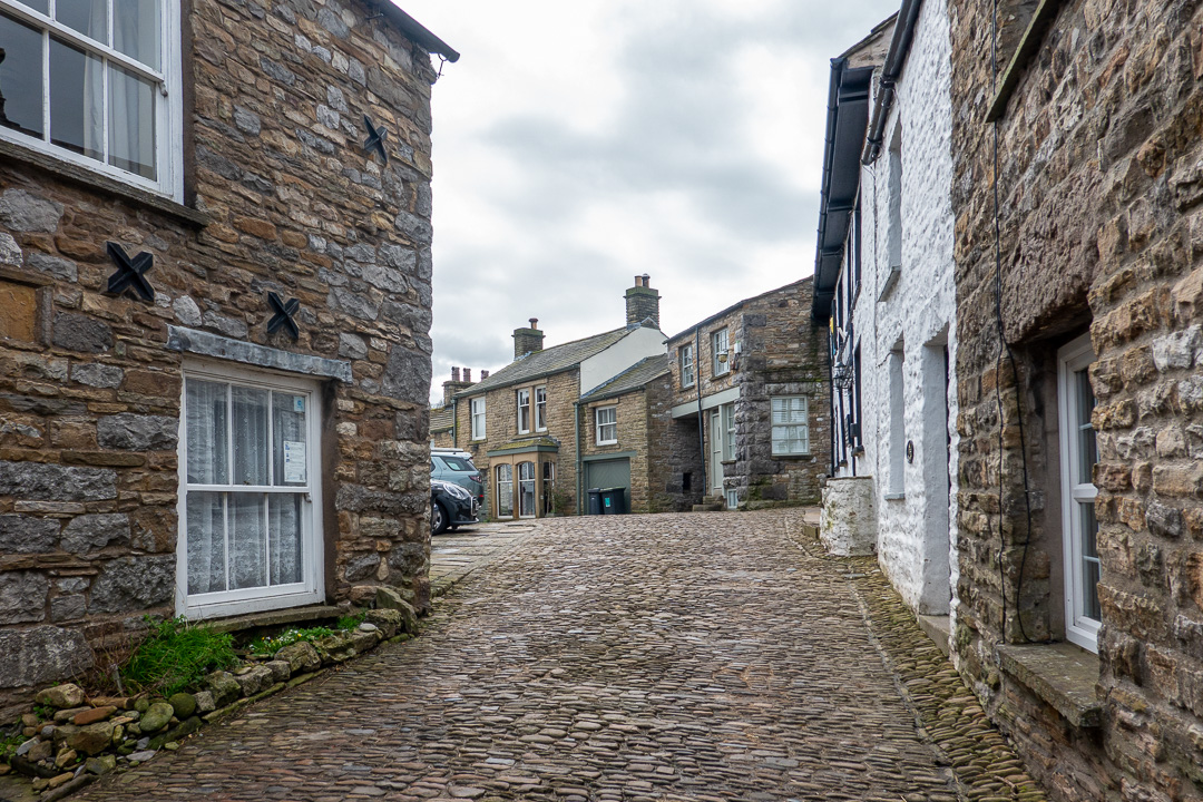
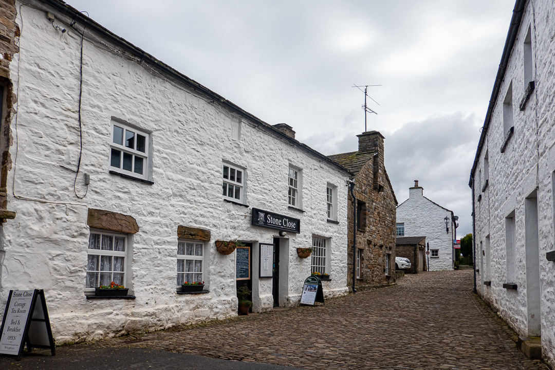
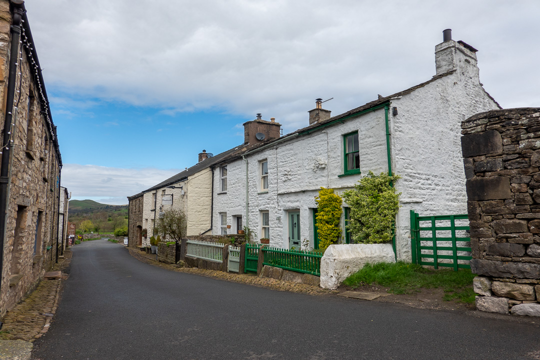
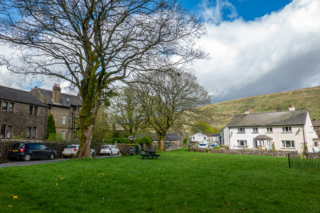
Dent is a pretty village, situated in Dentdale, a narrow valley. It has a very long history as a settlement and until, the local boundary changes in 1974, it was in the west Riding of Yorkshire. Nevertheless, despite being in Cumbria, it lies within the Yorkshire Dales National Park.

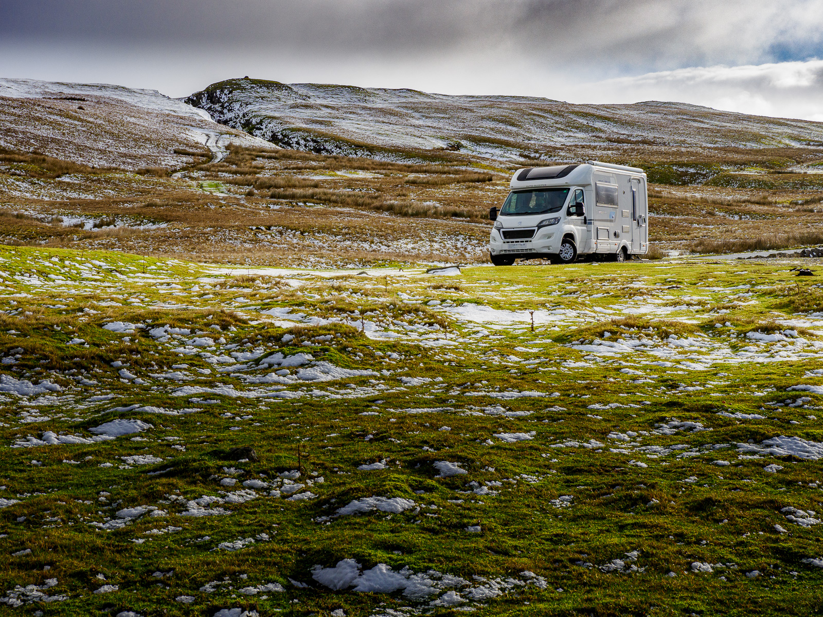
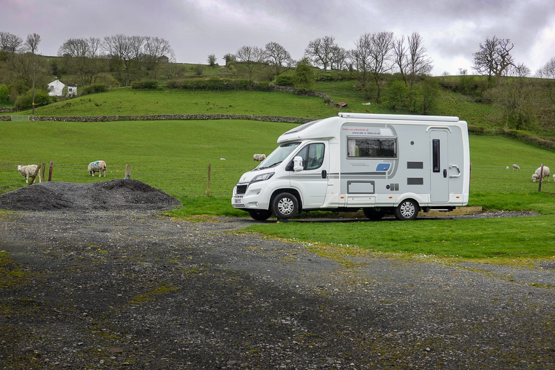
We had planned a visit to Dent for some time and the cancellation of other plans allowed us to go for the weekend. Staying at Mill Beck Farm, a small 5-van site certificated by the Camping and Caravanning Club, we were made to feel very welcome by the site owner, Christine.
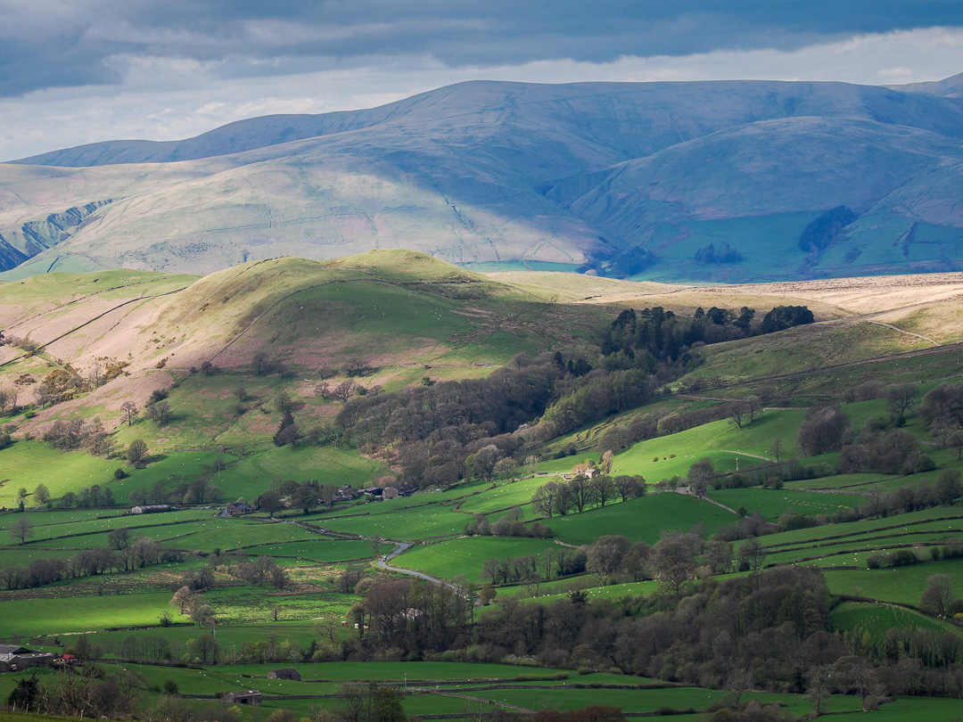
The journey up the M6 was dreadful with strong winds and horizontal rain, but we for once had faith in the weather forecast, looking forward to walking through the beautiful Dentdale countryside.
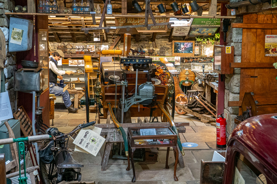
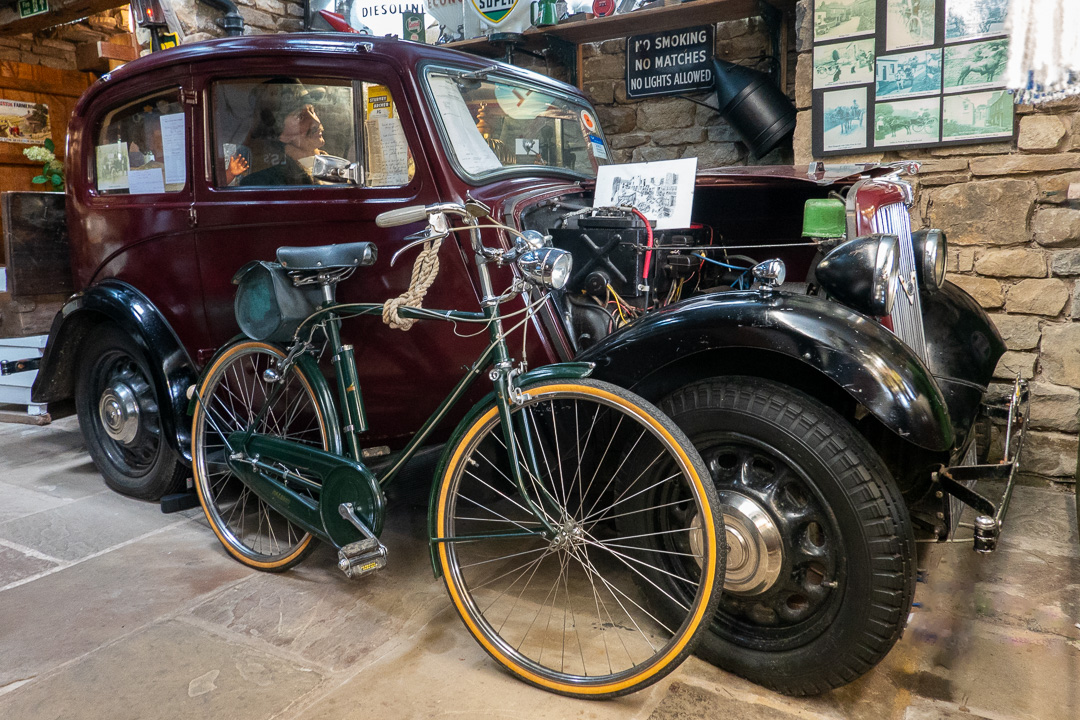
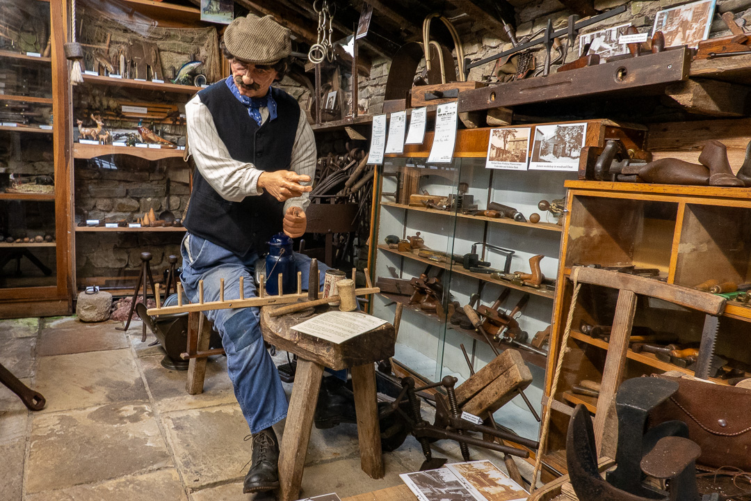
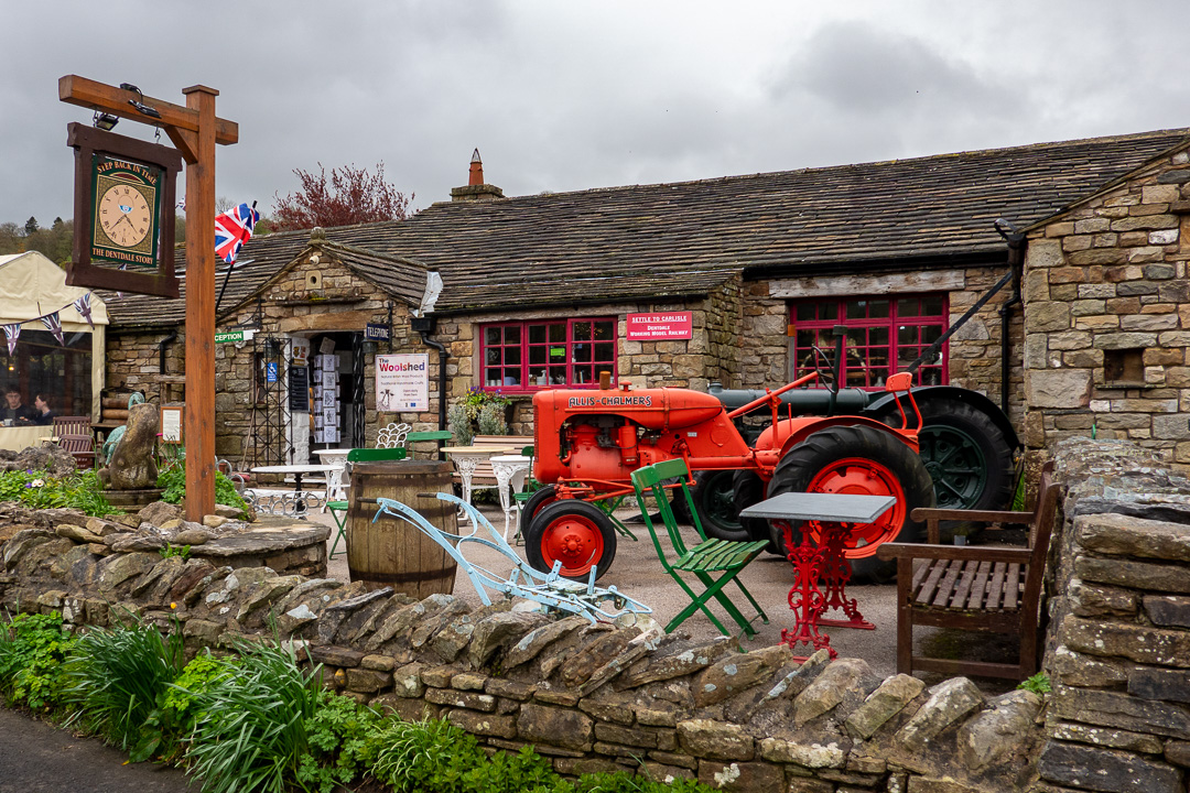
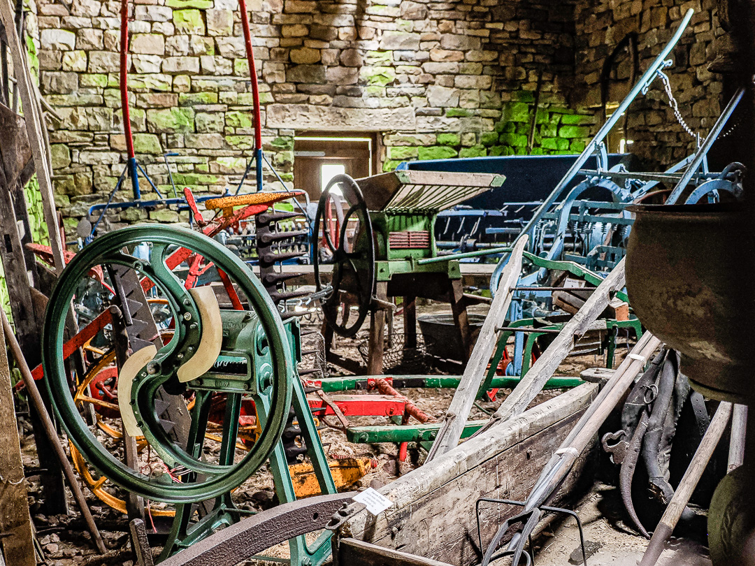
The Dent Village Heritage Centre and Museum is fascinating, with an abundance of exhibits. It is a bit disconcerting to find items in a museum, which you have memories of being in regular use. Clearly the result of being an old fogey.
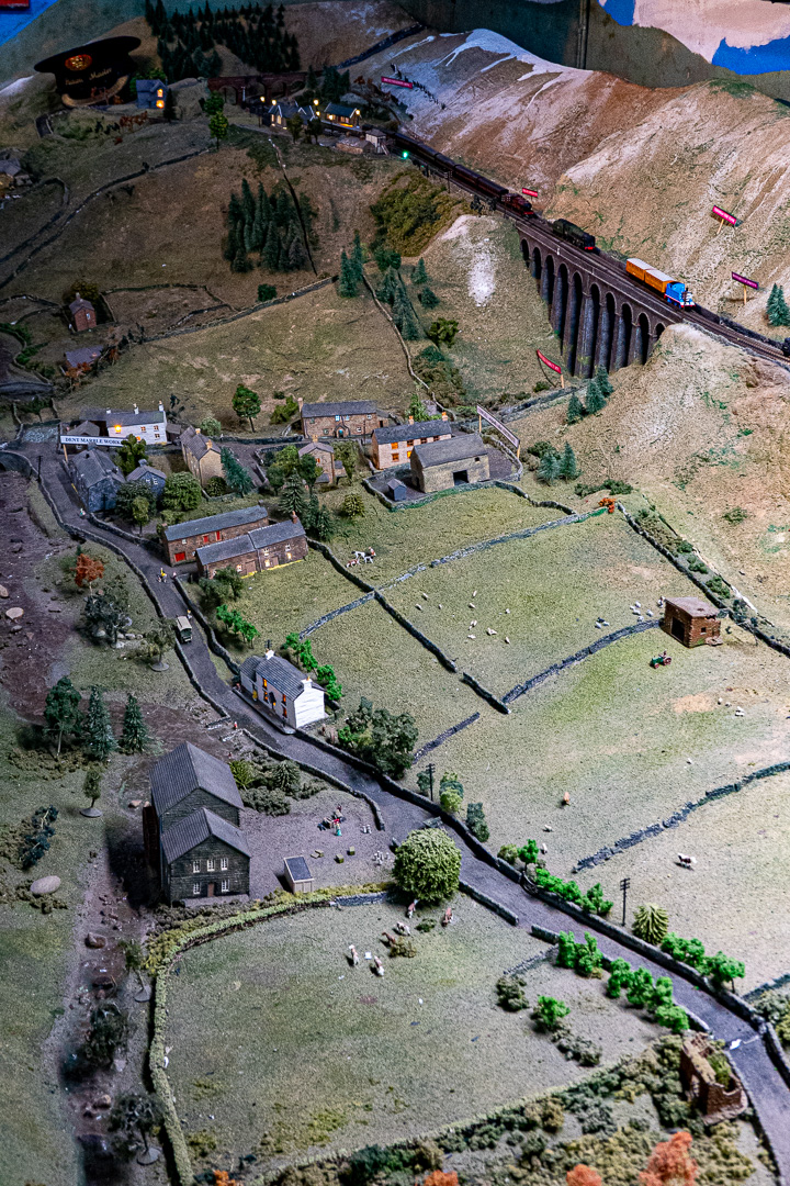
In the museum cellar, there is an N-gauge, model railway layout which presents the local topography in amazing detail. I am not sure whether Thomas the Tank Engine visited though.
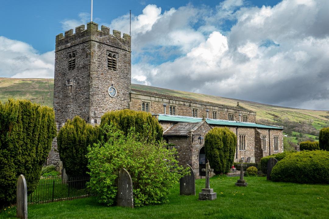
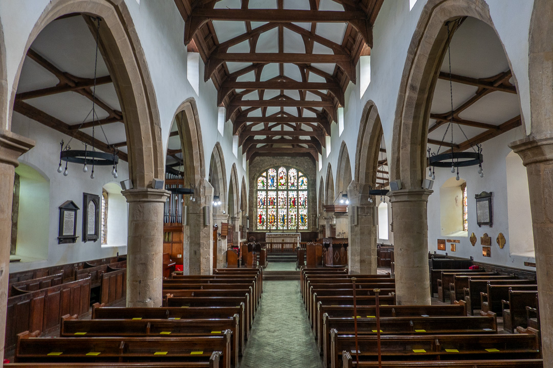
There are apparently 203 listed buildings in Dent and its immediate surroundings. The 12th century St Andrew’s Church, is grade 1 listed:
Friday 19th April
On Friday, we followed a heritage trail entitled, “A Walk Through Time Up Flintergill Outrake” which started from the village green, wonderfully named, “Dragon Croft”.
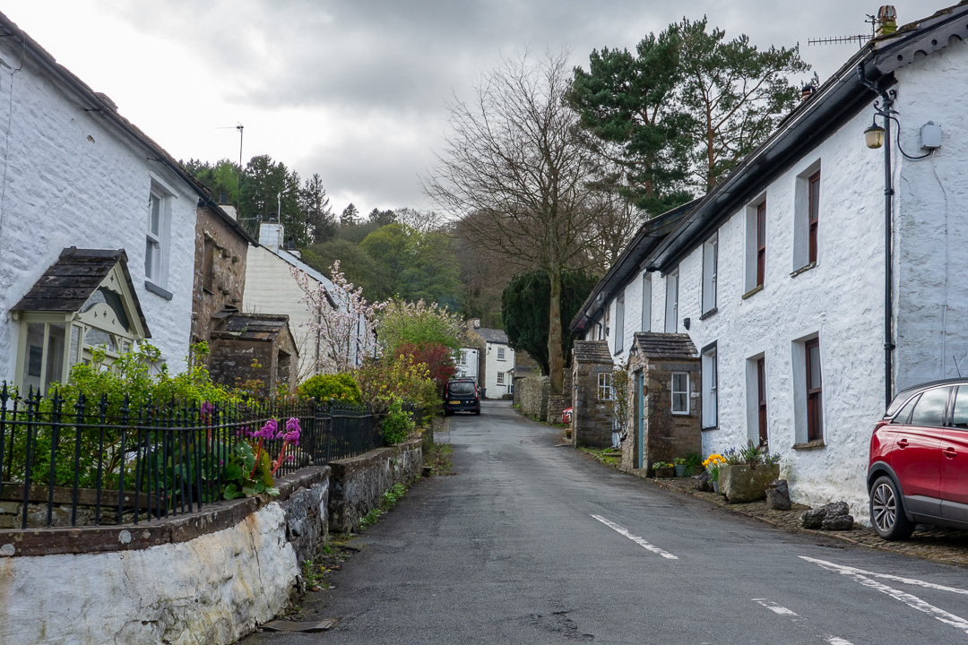
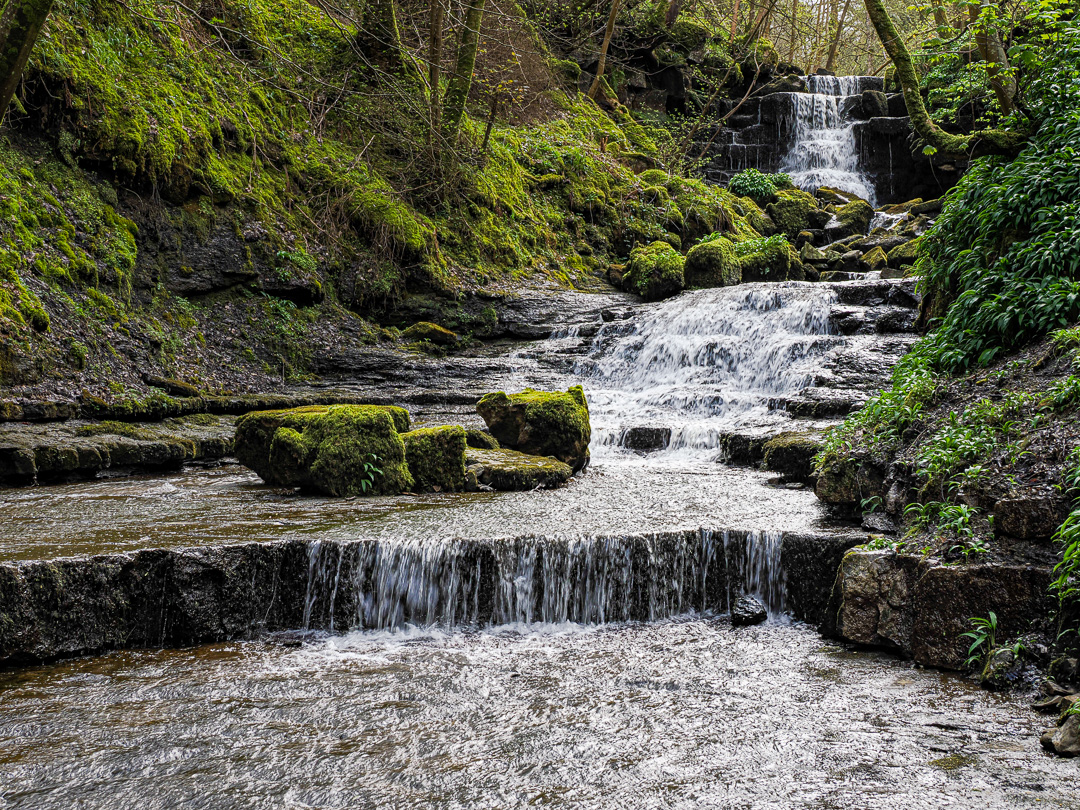
The path quickly becomes steep, narrow and stoney. Beyond the rows of weaver’s cottages, there are the “Dancing Flags”, a large area of flat rock slabs in the bed of the beck. so named as this was used by local weavers for “waulking” their newly-woven lengths of cloth, or “webs” as they were called. They would wet the fabric in the beck with bare feet, causing it to shrink and felt-up, making it warmer. This practice was termed “dancing the web”.
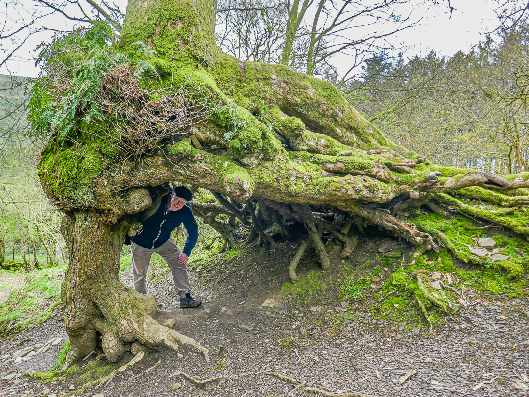
A little further on, we came to a tree, known as the “Wishing Tree”. Legend has it that the trees guardian spirit will grant a wish to anyone going through the arch of roots, three times in a “deiseal” or clockwise direction. Anyone doing this “widdershins” or anti-clockwise is bound to have bad luck.
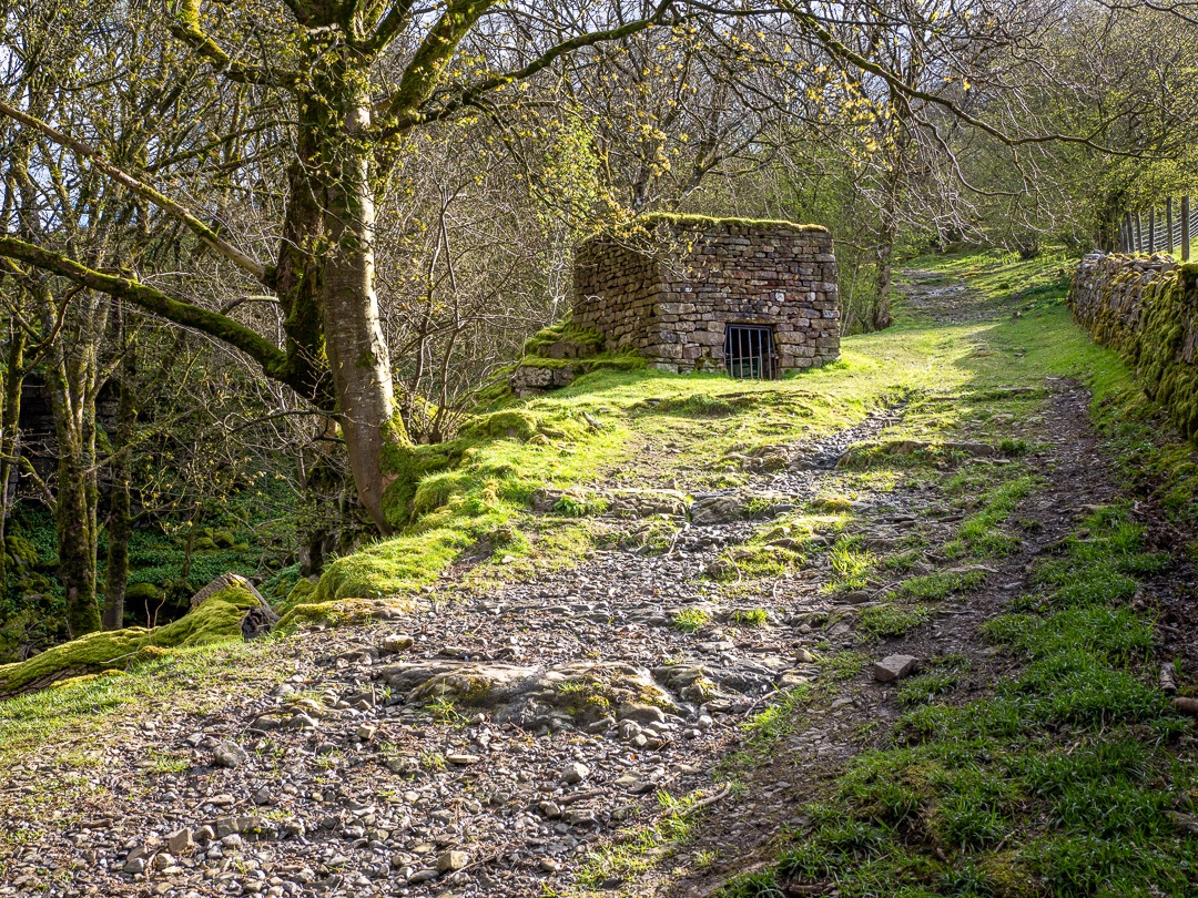
The path gets steeper just beyond this and the next point of interest is the lime kiln which has been restored. The kiln was used to burn limestone, which was used to make slaked lime.
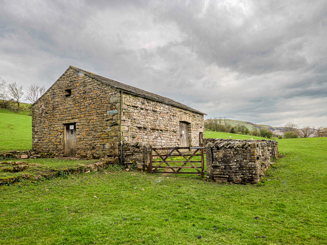
Almost opposite the lime kiln is Old High Ground Barn, which has also been restored. It looks like the farmhouse used to stand alongside. You are able to go inside and view the many old farming implements on display and learn about their use.
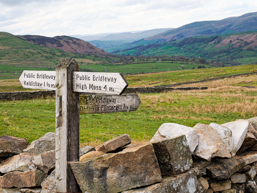
We chose to walk on a little further to where Flintergill Outrake meets The Old Occupation green lane, or “Occy” as it is known locally. This road was an ancient droving route.
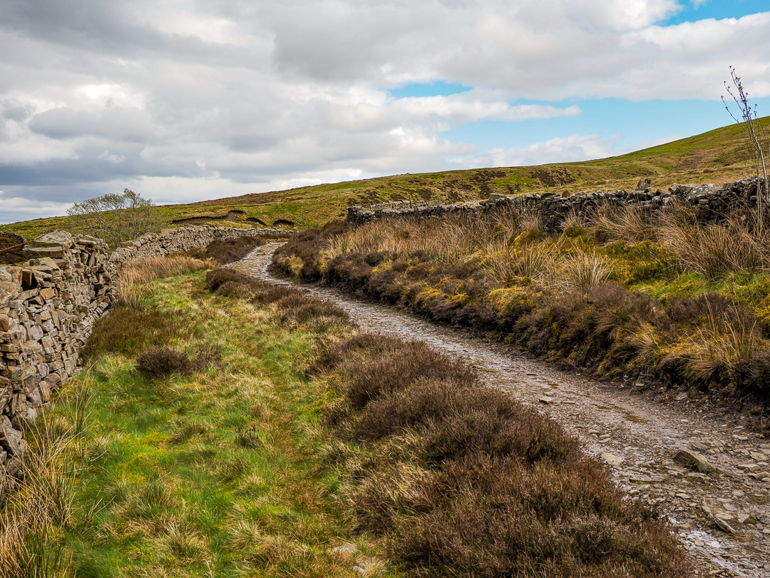
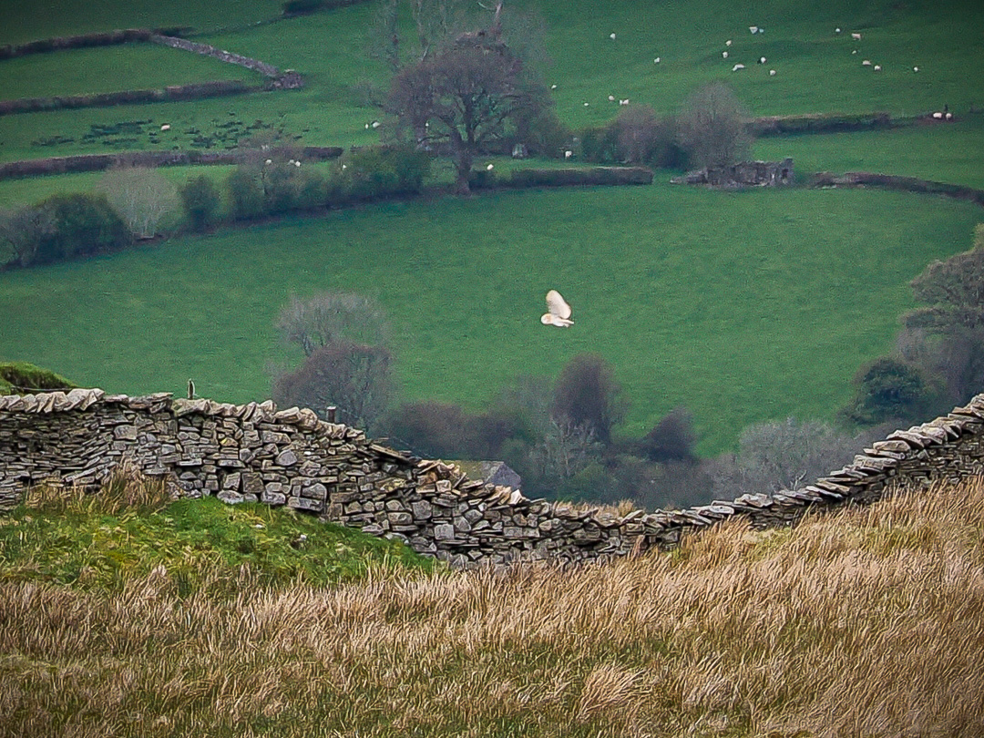
While we were at the Old Occupation Green Lane, we saw a barn owl hunting. Sadly it was a long way away; too far for a good photograph.
The path to the top is given as just 1.5 miles return, but by crikey the gradient made it feel a fair bit further.
Saturday 20th April
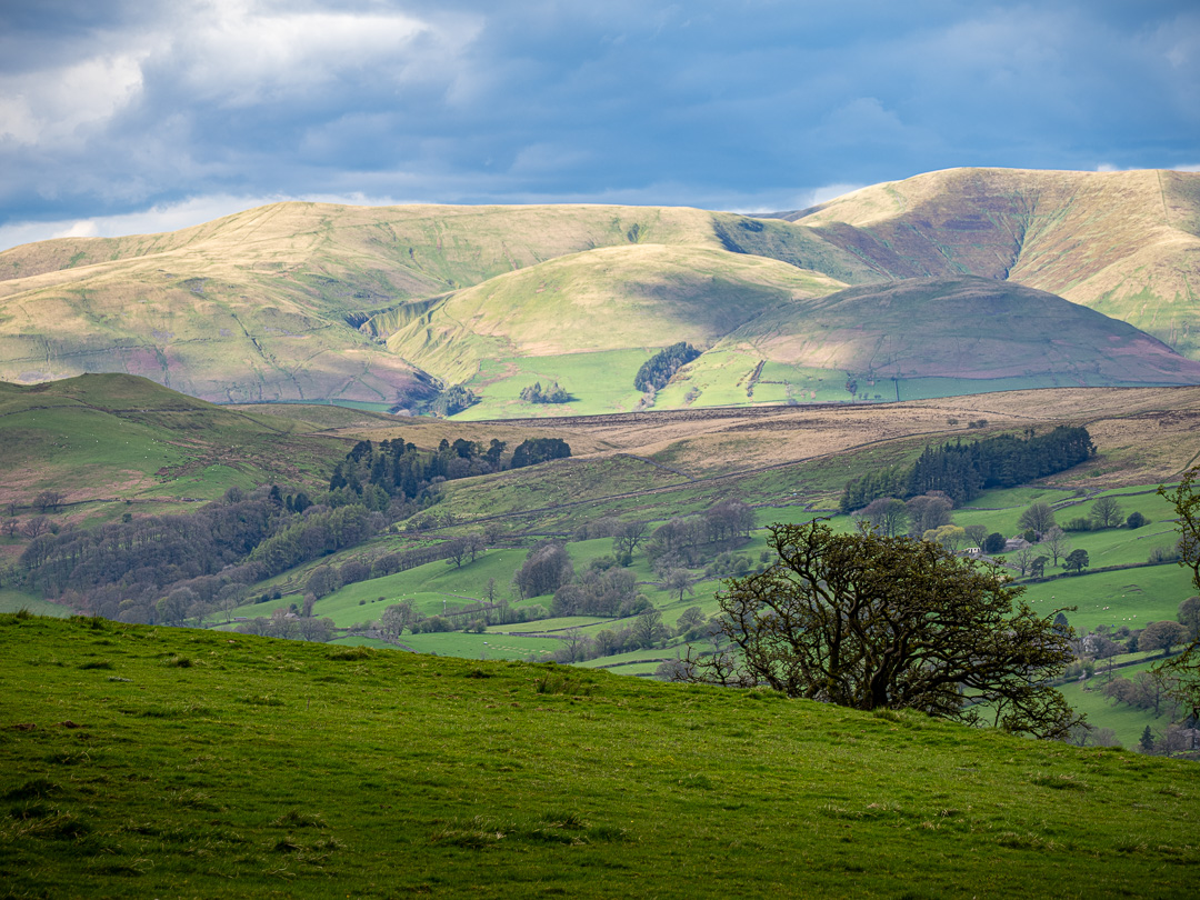
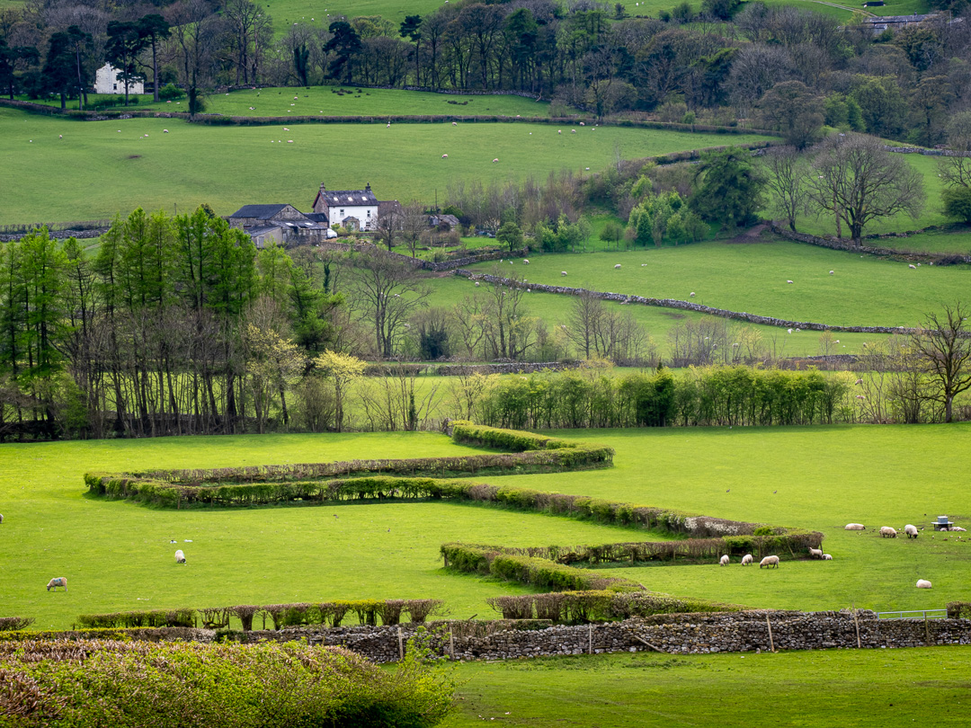
The following day, a more “gentle” walk was planned, along the valley bottom, towards Cowgill to the east. This is part of the “Dales Way” long distance footpath.
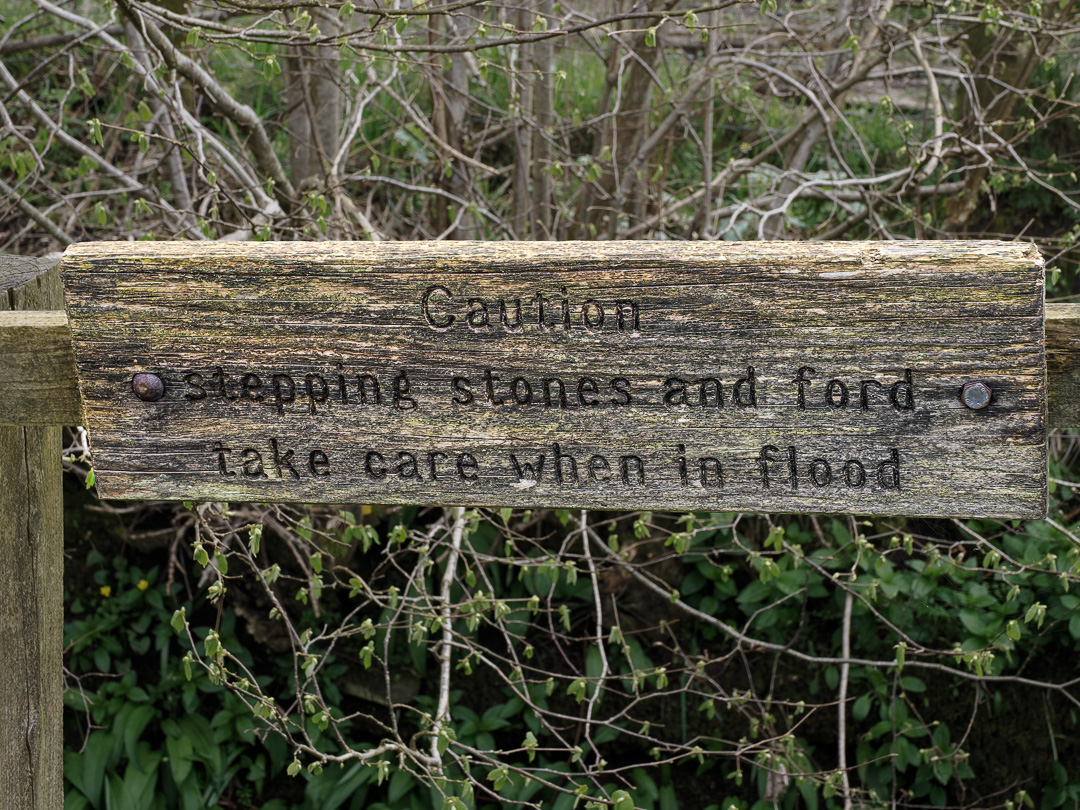
This section of the Dales Way follows the River Dee upstream. The river eventually joins the River Lune, which meets the sea near Lancaster. At one point the path splits, one way remaining The Dales Way and the other The High Dales Way. At the junction, the lower route crosses the river via Alison’s nemesis, …stepping stones! However today, the stones were well under water, making the crossing impractical, if not impossible, so we walked along the higher route and rejoined the lower path later, eventually returning via another path on the northern side of the valley.
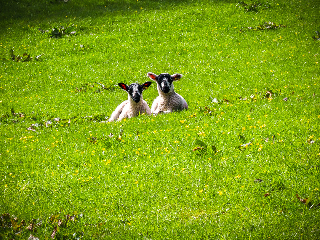
The landscape is stunningly beautiful and it is no surprise that we ended up walking further than originally planned, enjoying the scenery and admiring the many new-born lambs in the fields that we were walking through. They are so cute.
Sunday 21st April
On Sunday, we drove up the valley towards Cowgill, ignoring warnings about the narrow bridge just beyond the village. On the narrow, winding road there, we were fortunate that there was not much traffic as in places two racing cyclists would have struggled to pass each other.
I have no pictures of the bridge; we made it, but I am definitely glad that Fufu is no wider. The bridge is 7ft 6in wide, which is 1 inch narrower than the van’s specification.
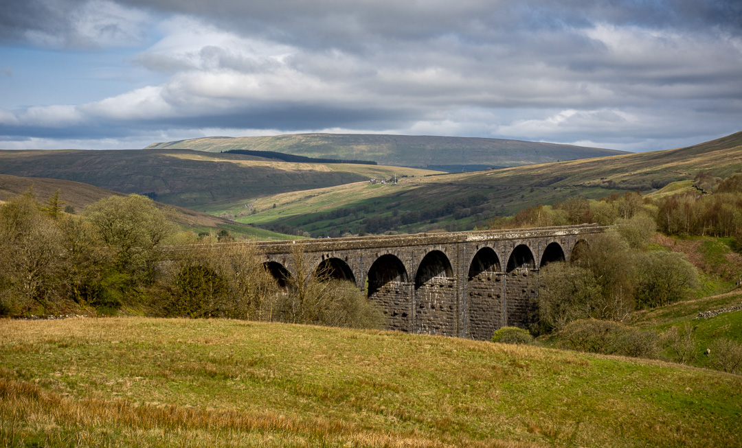
Arriving at Dent Head railway viaduct, we had a look around and marvelled at the accomplishment of the Victorian Engineers and builders. Although not as famous as the Ribblehead Viaduct, it is still amazing.
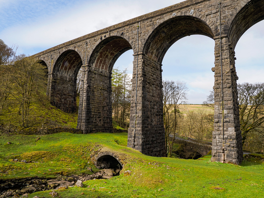
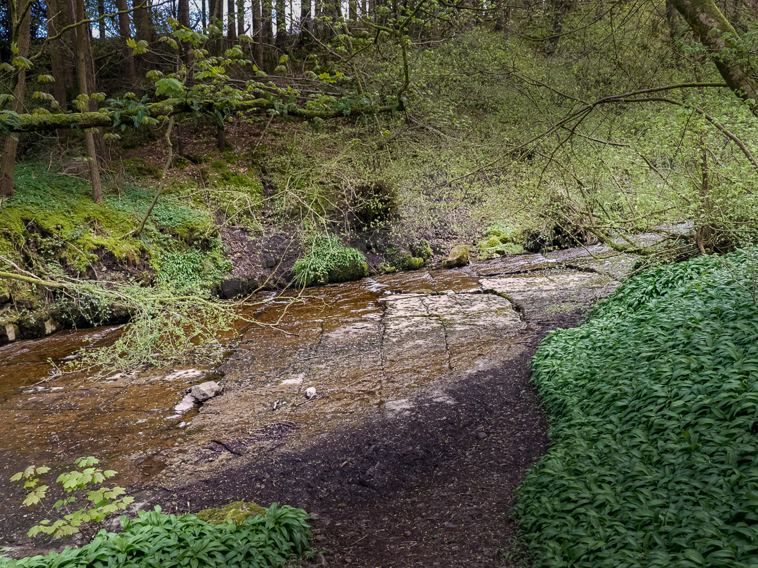
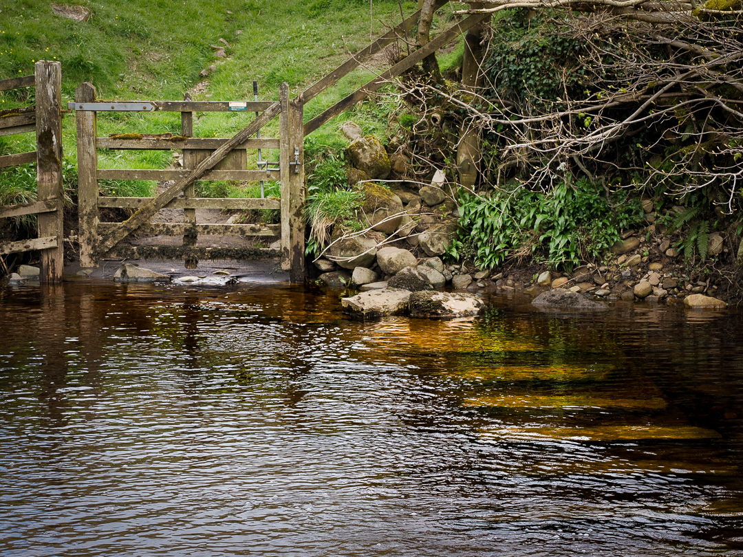
It would not be normal if I had not had some kind of foot-wetting incident. I was down by the stream in front of the culvert entrance in the image above and instead of walking around and over, as I should have, I chose to step across. Of course I slipped and fell in. There is clearly no hope of my ever learning a little common sense!
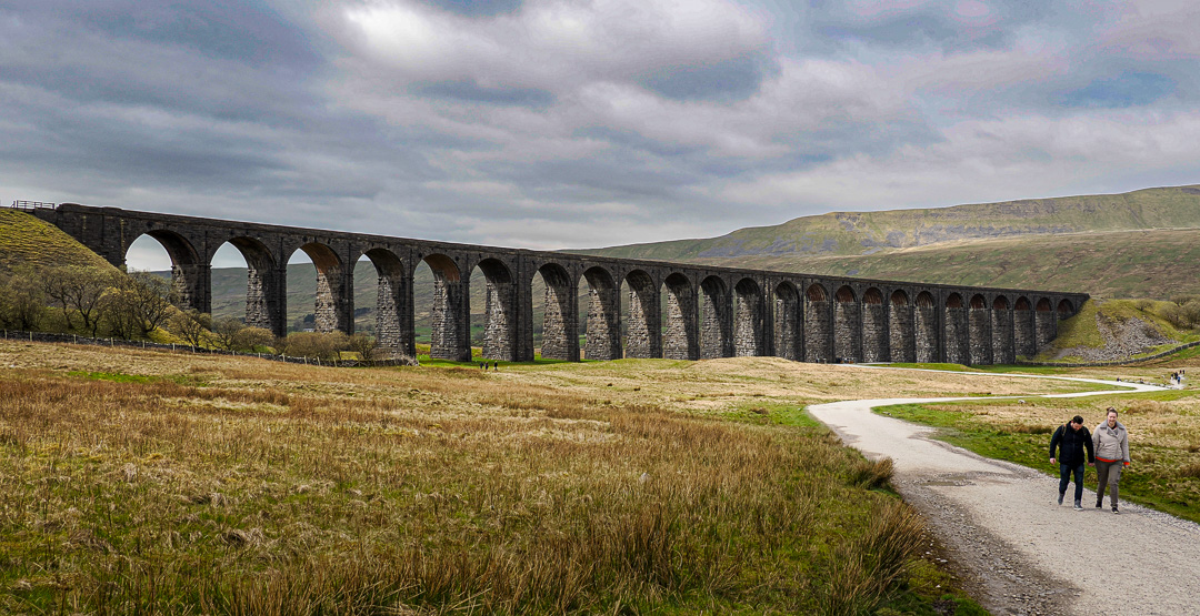
We then made our way to Ribblehead, and being a Sunday, it was busy but we were still able to park. It is a popular destination, particularly for motorcyclists, who seemingly passed us in a never-ending stream.
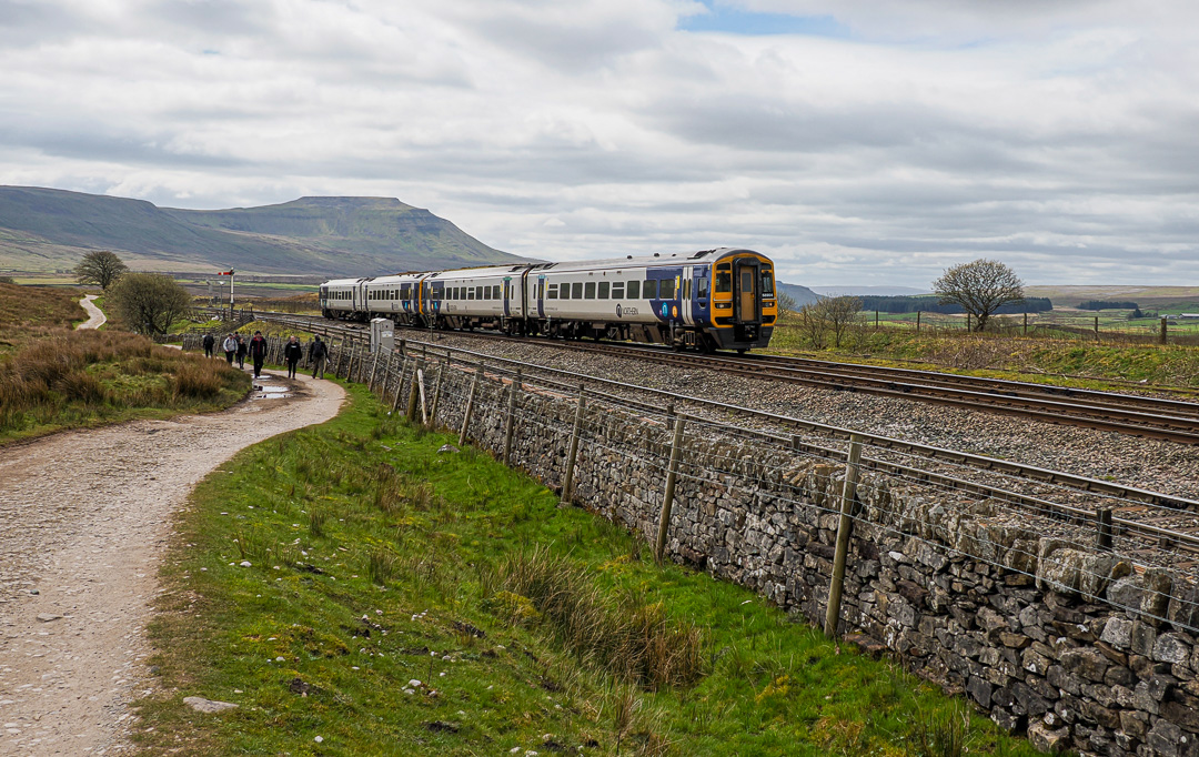
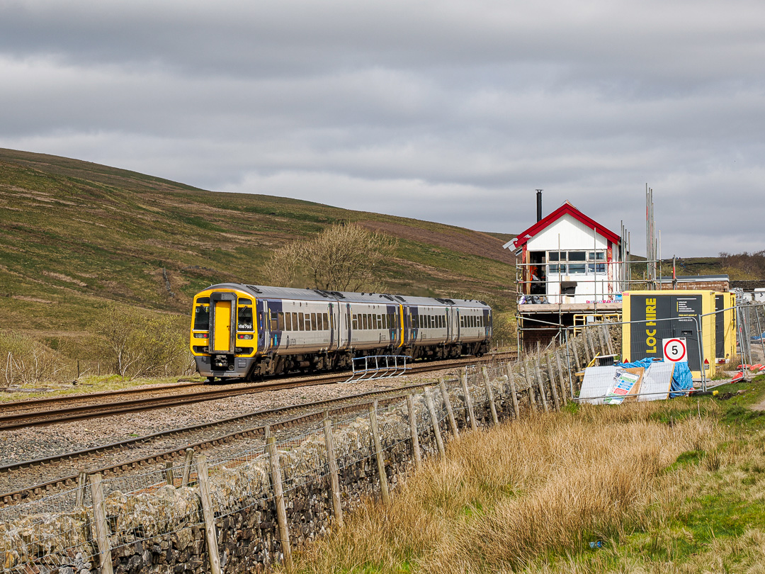
Alison wanted to look at Blea Moor signal box, which had recently been sold, so we walked up the path alongside the railway line, back towards Dent. The signal box is the most remote on the rail network and was commissioned to control rail traffic across Ribblehead Viaduct and through Blea Moor Tunnel, around a quarter mile beyond the box.
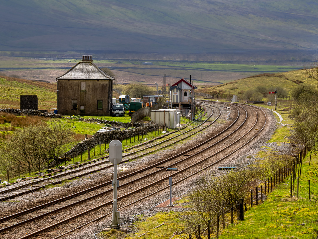
When we arrived at the signal box, we discovered it to be surrounded by scaffolding and contractor’s vehicles. Clearly it is being renovated. Hopefully they will also work on the adjacent signalman’s cottage which is also in need of TLC.


another very Interesting voyage! I know Dent, it’s beautiful. A friend taught at Sedbergh Grammar school years ago.
LikeLike